
Red Rock Canyon
Red Rock Canyon, California
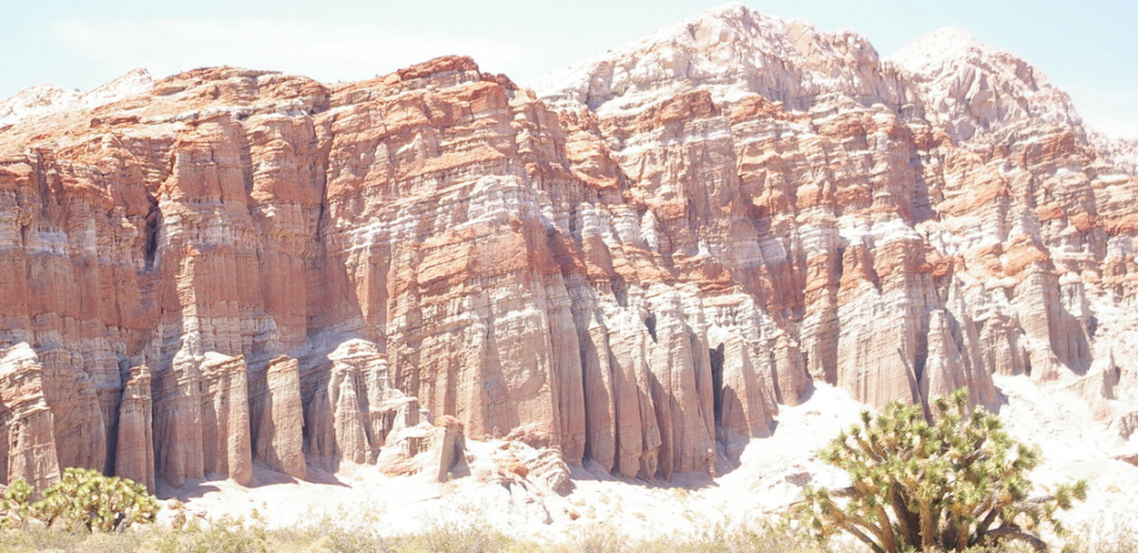
Red Rock Canyon was established as a state park in 1970. It has shelves of sedimentary and volcanic rocks that come in incredible formations resembling a palace fit for royalty. The rock formations here indeed inspire a palace of wonder and imagination. Red Rock Canyon is a badland, and the cliff face in the video is experiencing what is known as badland erosion.
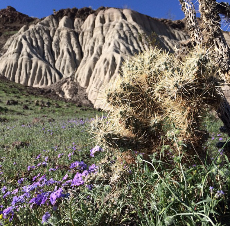
Tall desert Joshua Trees, the signature suessical Californian plants, reach into the sky, among the short bushy creosete bushes and other shrubs that declare this a desert landscape.
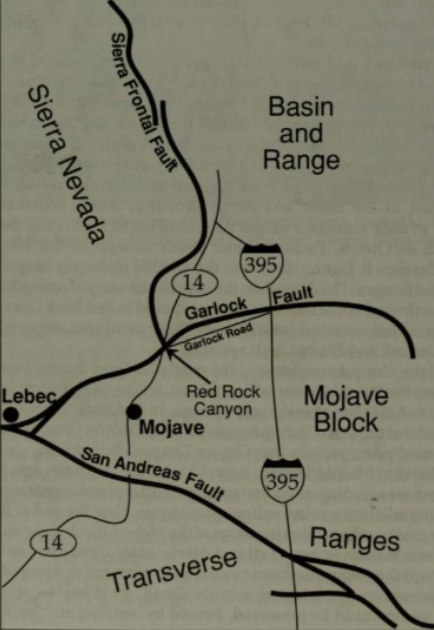

Red Rock is located at a triple junction between the Basin & Range, Mojave, and Sierra Nevada geological provinces.
The San Andreas fault, Garlock Fault, & Sierra Frontal Fault have interacted and evolved this region for millions of years.
photo: Geology Underfoot
In the areas earliest history, the Late Miocene, crustal extension in the Basin and Range province rifted, which stretched out the Earth’s crust, opening up a basin. As the basin subsided it became a trap for material to accumulate. Ancient rivers flowed from higher land depositing sediment into the basin which eventually emptied into a shallow lake. That lake created a fertile habitat that created ideal conditions for floral and fauna.

Notice the angle of the rock layers! They appear to be horizontal but upon further inspection the layers have a 15-20 degree dip in the west-northwest direction. Movement of the El Paso Fault, a high angle normal fault branching from the Garlock Fault (Carter, 1980) uplifted and tilted the rock, exposing the layers. There was a period of erosion before quaternary fluvial sediments overlaid the entire canyon.
Photo: Jeff Sullivan
Volcanism also occurred in Red Rock’s history. Dark gray-black basalt deposits can be seen with pink ash deposits between them in the video above. The chemical weathering of the ash and tuff layers add to the colorful landscape. Volcanic material is rich in minerals that interact with the elements adding the browns, pinks, and green colors found in the strata.

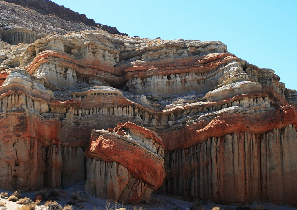
Red Rock Canyon is an arid badland. Badlands are called so because they historically are harsh and uninhabitable, not who you take home to mommy. Badlands have sedimentary deposits that are easily eroded, yet are impermeable and structured and enough to stand with steep faces.
photo: Turks Turban Brocken Inaglory
Badland topography is terrain where infrequent but heavy rainfall cuts deep drainage channels, separated by thin steep ridges. In the video above the temple-like topography are products of badland erosion!
Rain splash, where rain karate chops the bare surface of the rock, is the dominant erosional process here. Runoff or ‘slope wash’ carves out the vertical gullies in the cliff face. These gullies are called ‘scarp slopes’ which represent Red Rock as a mosaic of columns, spires, flutes, chutes, and alcoves. If you need a nook and cranny, this is your destination.
Check out the area in map view and this awesome drone footage of the area by BlackBoxGuild

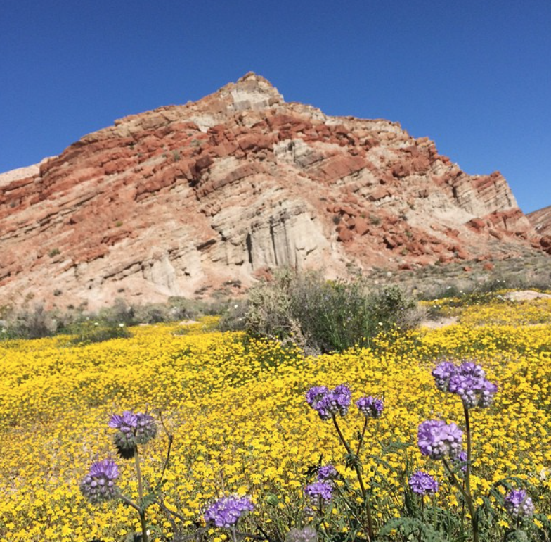
Resistant sandstone is present between less resistant layers of siltstone, shale, and limestone. The main stratigraphic unit seen here is the Dove Springs Formation of the Ricardo Group. It is a 5,600 foot thick layer of sandstone, mudstone, lake deposited silts and clays, and sandy gravel, interbedded with rhyolitic tuff and basalt. The classic red hues of the sandstone beds that the region is famous for occur from oxidation reactions with iron bearing minerals. The white layers are prominently volcanic ash deposits.
The Doves Springs formation is replete with flora and fauna fossils in the strata that are present from the shallow lake in Red Rocks history. Remains of early horses, camels, mastodons, rhinos, wild dogs, pronghorn antelopes, deer, skunks, cats , weasels, 1 goose species, and , sabertooth tigers are present in the fossil record of the Dove Springs formation! Many tree species such as pinyon pines, locust, cypress, acacia, and palm tree fossils are also found here. These fossils are evidence of what a lush, wet environment once existed here. The fossilized plants tell us that the area required at least 15 inches of annual rainfall, rather than the 5 inches the area gets now to sustain the life once present (Sharp and Glazner, 1993). The Dove Spring Formation is one of the most complete records of middle Miocene strata in the entire world!
The natural beauty of Red Rock Canyon is an unassuming treasure trove of history and geology. It’s surficial beauty only gets more interesting as you dig deeper. Please check out our other videos to explore Earth’s wonders!
Author: BreeAnn Getman