Mars DEMs
High-resolution Digital Elevation Models for Mars
Digital elevation models (DEMs) provide critical information about the three-dimensional geometry of surface outcrops on other planets and can help test different hypotheses. The GALE Lab has created over 1300 DEMs from HiRISE images at a point spacing of 1 meter-per-pixel, and even more from CTX images at a point spacing of ~6 meters-per-pixel.
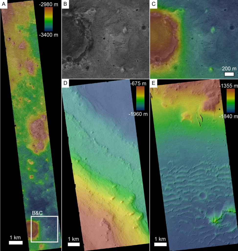
Digital elevation models created by the GALE Lab from high resolution imaging of Mars. A) A HiRISE image and overlain colorized elevation showing eroded terrain in Arabia Terra. B/C) A pedestal crater in (A) with a much higher interior than the surrounding plains. This elevation difference is clear with the color DEM, but not with the image alone. D) Layers on the sedimentary mound in Henry crater (Day and Catling, 2019). E) Indurated dunes in Apollinaris
Sulci (Hunt et al., 2022).
Accessing the library of DEMs
All UCLA Mars DEMs are available for public use. Finished products are hosted on the NASA PDS and are available for download here:
https://astrogeology.usgs.gov/search/map/mars_human_exploration_zone_dem_archive_2023
Additional documentation, including a shapefile of the generated DEM coverage, guidance on how to use the filed, and a discussion of sources of error, is available here:
https://github.com/GALE-Lab/Mars_DEMs
New DEMs are being made all the time in the GALE lab, and we will happily take requests for new products. Researchers interested in requesting new DEMs or accessing existing ones should contact daym@epss.ucla.edu.
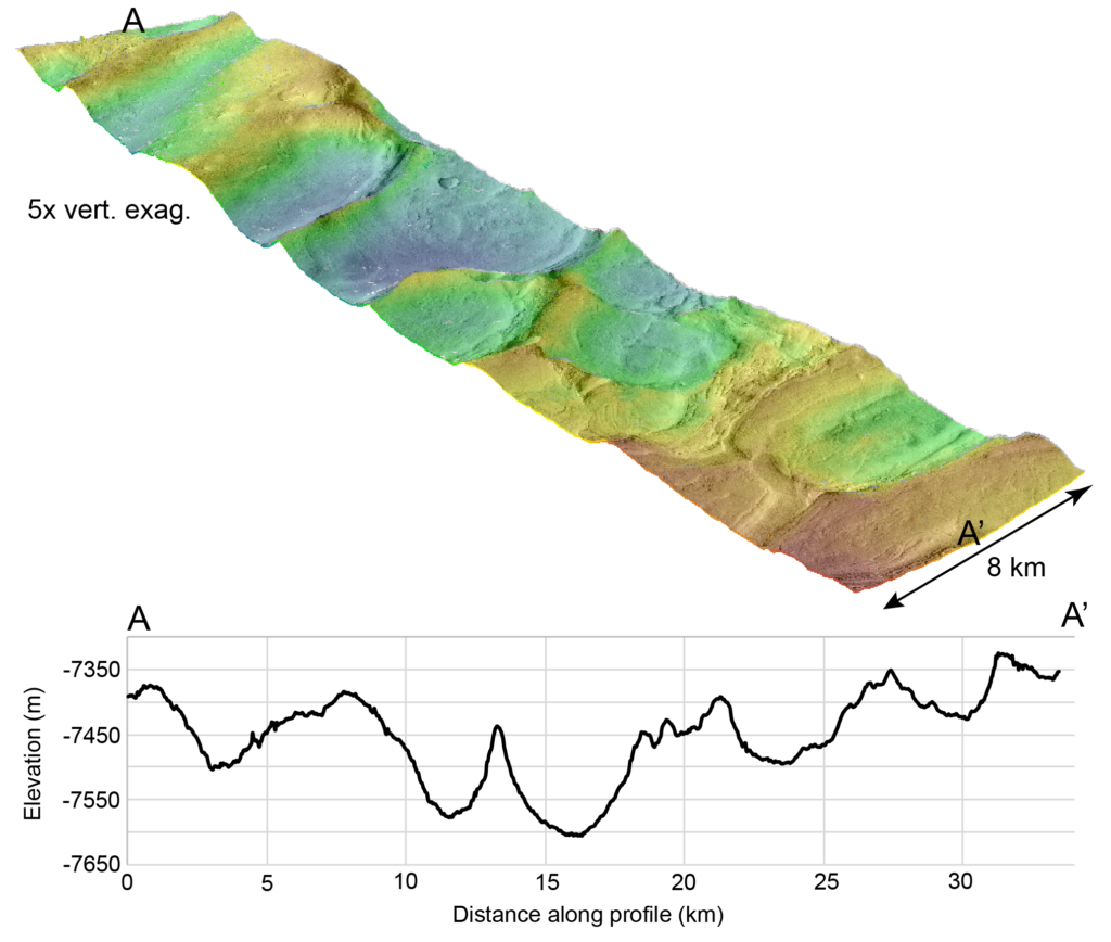
A perspective view and elevation profile from a DEM made over Honeycomb Terrain in Hellas Basin Mars. This CTX DEM exaggerates the troughs and ridges from regional folding.